Mandala is located in the area administered by the Southern Downs Regional Council. It is about 140 km south west of Brisbane and 40 km north east of Warwick.
Our 112 hectares occupy part of a valley in the western foothills of the Main Range within easy access to Main Range National Park including some of the finest scenery and best bushwalking in Australia. Lying at an altitude between 530 and 713 metres, Mandala enjoys milder, less humid summers than coastal Queensland and colder winters with frequent frosts.
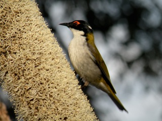
The country is mostly dry sclerophyll forest merging into wet sclerophyll in the riparian areas adjoining nearly three kilometres of double creek frontage. This creek can become a torrent during wet periods, but dries to a series of water holes in drier times, particularly during winter.
Fifteen shareholder homesites occupy fifteen hectares. The remaining 97 hectares of common land, including the entire riparian area are mostly given over to conservation, however about 20 hectares are set aside for human purposes including grazing areas and our community centre.
In January 2012, after signing a conservation agreement with the Queensland Government, Mandala became a gazetted Nature Refuge.
Our community centre includes a meeting room, workshop, a shelter shed and camping ground with a BBQ and water supply and accommodation for our tractor and other shared equipment. A permanent pool in the creek supplies our farm-wide water system, which reticulates at high pressure to all homesites. A pedestrian swing bridge and a manually operated cable car provide access to several homesite during the infrequent occasions when the creek is in flood.